Find Out What's Proposed for Your Area
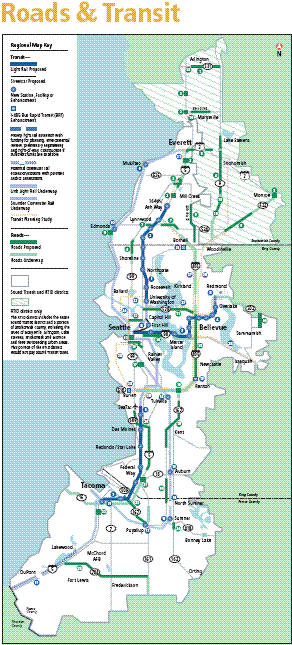
 The proposed Roads & Transit package is intended to improve the flow of traffic at major chokepoints in the Puget Sound region. This conceptual map shows chokepoints as well as current and proposed road and transit investments.
The investments are organized into North, East/Central and South corridors, as indicated. For details about what is planned for each area, please visit the corridor pages:
East/Central Corridor Projects
The conceptual map above will be updated shortly to reflect the Blueprint as recommended by the RTID Planning Committee on June 8, 2007.
